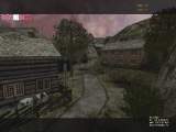
| Screenshots |
|---|

|
| click image for larger view |
|
| Name: |
dod_kirkenes35 |
| Rating: |
 |
| Author: |
spine |
| Date Added: |
Oct 10, 2006 |
| Download: |
 |
| Size: |
Not Available |
| Description: |
Large countryside map |
| Review: |
Last version of Kirkennes
Brit map
From the readme
"History:
Hitler's "Festung Kirkenes" was a base in the far north
of Norway, for about 500.000 German soldiers at the
North East front. Before the ocupation,
the Kirkenes settlement was about 7.000 people.
The ice free harbour and an easy conquered inlet made
Kirkenes a vital point for land and sea communications,
for the whole of Norway and North of Finland.
The Germans were to use this North East front to send
troops into Russia. Because of this, Kirkenes, next after
Malta, became the most bombed place in the whole of WW2.
The town where a constand target for the Brittish
bomber's at the start of the war and then towards the
end the Russian's took over the heavy bombing.
The last standing buildings where burned down on command
by Hitler when the Nazis ran from the invading Red Army
which arrived 25. October 1944.
When the war ended there where no standing buildings left.
Due to this games limitations the Red army has to be
replaced by the British,which also played a big part in
the liberation of "Festung Kirkenes" and the rest of Norway." |
|